Lesson 1: Track Your Trip
ISAT Test Prep Skill: Physical Science Student goals: Learn how to read a map and identify key cities, landmarks, rivers, state boundaries, and train routes; solve basic mathematical problems Time required: 40 minutes
 Materials required: Directions: 1. Display the map in the classroom at a level where all students can view it and reach it. 2. Review the components of a map legend with the class (i.e., ordinal directions, legend, and scale measurement). Ask Students:
• Can you find three cities with a population
between 50,000 and 150,000?
• Which states border Illinois?
• Which part of Illinois produces wheat?
a) north; b) south; c) central; d) northwest
3. Distribute Track Your Trip student reproducible 1 (PDF)to each student and read it aloud with the class. 4. Have students answer the questions by referencing the map. 5. As a class, review students’ answers. Wrap-up:
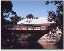
Photo Credits: Photo courtesy of Amtrak. View and print items marked (PDF) using Adobe Acrobat Reader© software, version 4.0 or higher. Items marked (PDF Form) feature editable areas. Save edits with version 7.0 or higher. Get
Adobe Reader for free.
|
Generously sponsored by   |